
Project 07
WeathAR App
A weather app with a built-in augmented-reality feature that projects real-time weather over a physical map, the AR animation shifts with place and time.
Augmented Reality
3D / Art
Role
Product Designer
Timeline
3 months (Oct–Nov 2021, NYU)
team
Solo
platform
Mobile / Physical Spaces
Tools
Lens Studio, Android Studio, Figma, 3ds Max
Overview
WeathAR integrates live weather data with augmented reality: using Lens Studio, it projects weather details over four zones on a map of the USA, and the AR animation changes based on place and time. The idea came from an artist presentation I gave on AR artists, I wanted to bring that kind of data into AR. I started by engraving the map on cardboard and tracking the image through Lens Studio, then built a topographic map by layering cardboard for a 3D depth effect.

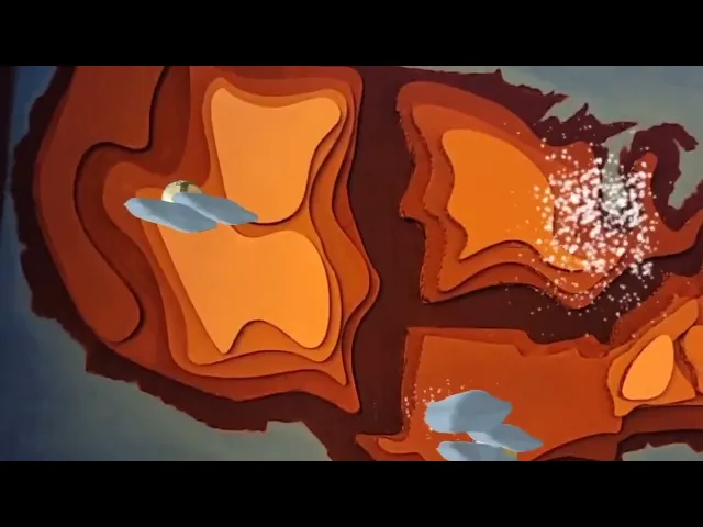
A hand-built, layered-cardboard topographic map of the USA the physical AR marker and the engraved base map, tracked as an image target in Lens Studio.
Process
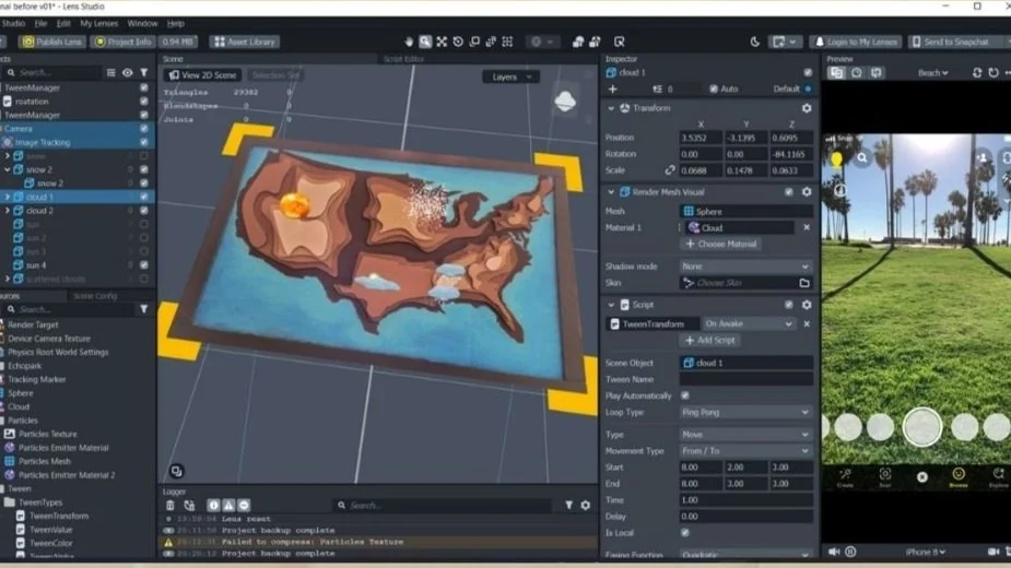
I used 3ds Max to model the 3D objects, sun, clouds, snow, and rain and brought them together in Lens Studio (Snapchat). I wrote code to integrate the lens and the animation I'd created, and got approval from Snapchat to make the lens active but hidden, accessible only through my app. The review process usually takes about a day and updates whenever the lens is used. I learned a lot of animation techniques through Lens Studio this project was my jump-start into AR and into experimenting with different ways to integrate art and data.
Lens Studio workspace: Building and animating the weather objects in Lens Studio, tested against the map.
Building the App
Making the app in Android Studio was a big learning experience. Coming from a design and media background, building an app was a real stepping stone. I designed the interface and application, pulling the weather data through a web weather API, and ran several test runs to make sure it worked linking the Lens Studio lens into the app through lens-button integration.
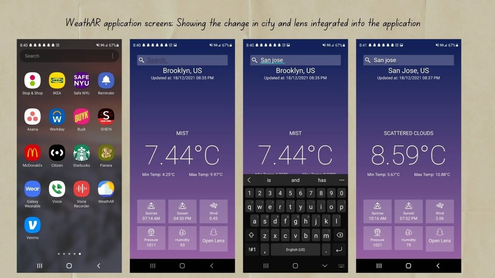
The app's weather screens: real-time conditions and temperature across US cities, with an 'Open Lens' entry point.
Opening the lens camera to reveal the AR weather feature by hovering over the map.
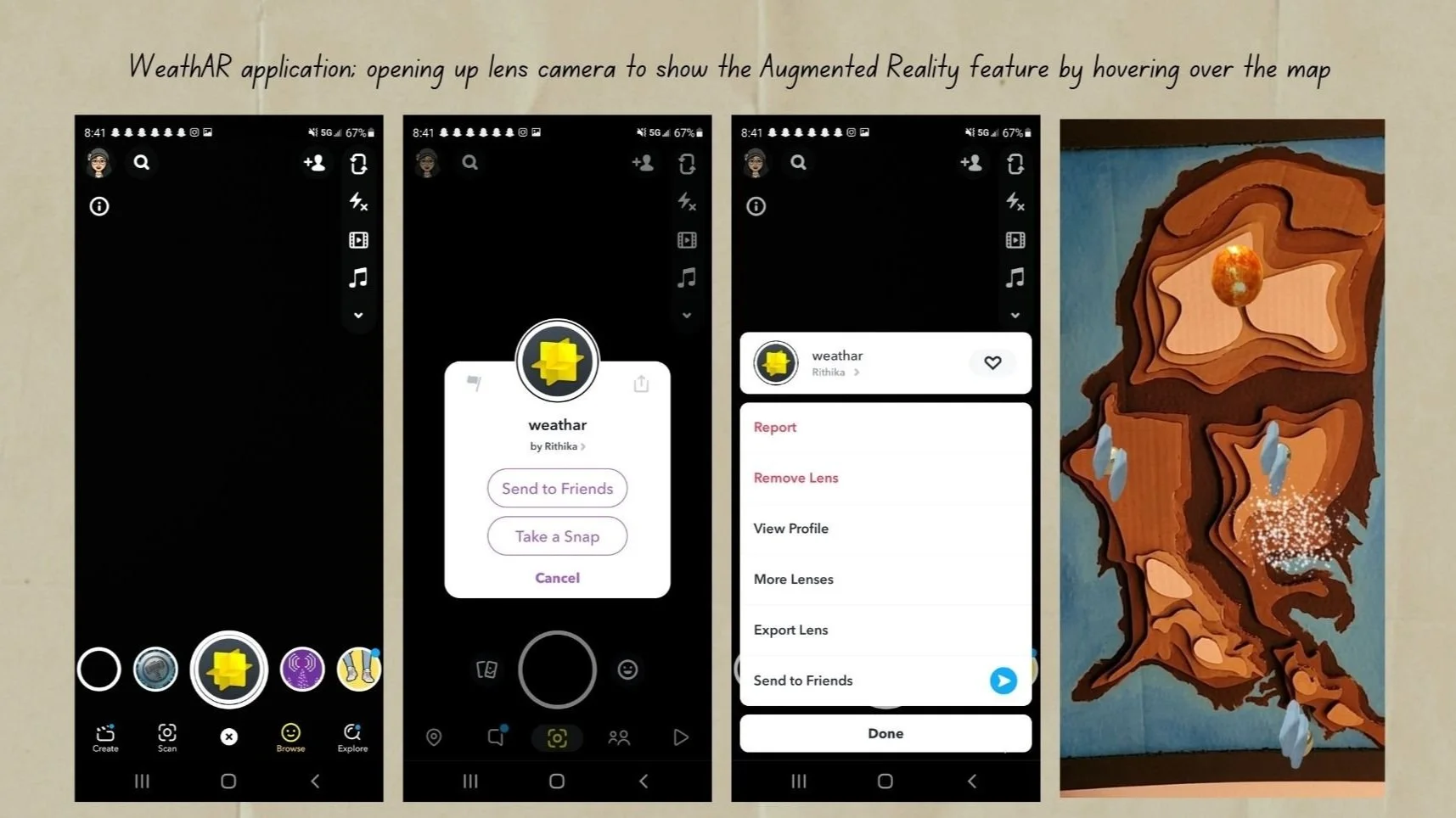
How It Works
I recorded the change in weather over a week and documented the process. The animation intensity maps to the weather, faster animation indicates peak or extreme weather at a location.
Conclusion
WeathAR became my entry point into AR ,combining 3D modeling, Lens Studio animation, app development, and live data into one experience. It taught me how to bridge art and data, and pushed me to build and ship something technical outside my original design background.